Because of the way boundaries were drawn, the state of West Virginia has two panhandles. The panhandle pointing northward is known as the Northern Panhandle. The panhandle to the east of the state is known as the Eastern Panhandle. These two panhandles give West Virginia the appearance of a leaping frog. They, also, explain one of the state's nicknames: The Panhandle State.
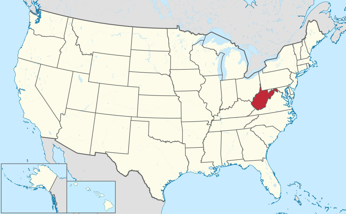
West Virginia is located on the east coast of The United States of America. It is said that West Virginia is the most southern northern state and the most northern southern state. The northern region of West Virginia has the characteristics of the Northeast or Midwest. The southern region has the characteristics of the South.
Who Surrounds Us?
Two
of the states bordering West Virginia, Kentucky and Virginia, are in the
Southeast Region of the United States. Our neighbor, Ohio, is in the Midwest Region. Pennsylvania
is in the Northern Region of states. Maryland is an anomaly. There is
disagreement about whether it is a northern state, southern state or a mix of
both. If geography is the only consideration, Maryland is a Southern
state because of its location below the Mason-Dixon
line.
Pennsylvania, to the north of the state, is a place where many West Virginians sought employment. They found jobs in Pennsylvania and raised their families there.
Ohio, to the northwest of the state, is also a major area where employment was sought by West Virginians. Many sons and daughters of West Virginia left the state to seek employment in Ohio.
Kentucky, to the southwest of West Virginia, is the state where the McCoy family of the Hatfield-McCoy feud mostly lived. The Hatfields mostly lived in West Virginia.
Maryland, to the northeast of the state, was the employment destination for West Virginians who lived closer to the eastern panhandle. They found jobs around the Washington, D.C. and Maryland area.
Virginia, to the east and south of West Virginia, is the state from which West Virginia was formed. Natives of West Virginia, who sought employment in Washington, D.C. area, often made their homes in Virginia.
The Great Seal of the state of West Virginia was adopted in 1863. Though it was designed with two sides, the front side of the seal is the one most used. In the green grass, below the figures and boulder are two crossed rifles and a liberty cap. They signify the state's fight for freedom. The two figures, a miner with a pickax and a farmer or lumberman with an ax and plow, represent industry and agriculture. Identification of the state of West Virginia circles the top of the seal and the state motto circles the bottom.
The reverse side of the Great Seal is circled with mountain laurel and oak leaves. In the center are mountains and hills. One small hill bears stumps from felled trees with a forest behind, representing the lumber industry. Farming, manufacturing and the rail system are also represented. This is the official seal used by the governor of West Virginia. The motto reads: Libertas E Fidelitate, Liberty out of Fidelity.
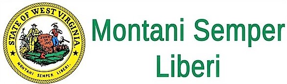
The West Virginia Coat of Arms has at its center the same design depicted on the West Virginia State Seal. The design is surrounded by a gold flourish on the inside and a wreath of Rhododendron Maximum on the outside. A red ribbon at the top of the coat of arms identifies the state. Another red ribbon holds the state motto, Montani Semper Liberi.
The State flag of West Virginia is bordered with a blue stripe, representing the Union. Resting on a pure white field, in the center of the flag, is the West Virginia State Coat of Arms .
I pledge allegiance to the flag of West Virginia, which serves
as a constant reminder that "Mountaineers Are Always Free," which
stands as a symbol of her majestic mountains, fertile forests, rich
veins of coal, and the pride of her people.
As unanimously adopted by the Secretary of State's office after
being duly moved and second by Charles S. Smith and Carol J.
Calvert, respectively, and voted upon by the following:
Before West Virginia adopted official state colors, the school colors, old gold and blue, of West Virginia Universitywere used. So uniformly were thecolors used throughout the state, that most people thought they were the official state colors.
In 1963, West Virginia's centennial year, the colors Old Gold and Blue finally became official state colors. By Senate Concurrent Resolution 20, the colors were adopted by the State Senate and House of Delegates.
According to the widely used Pantone color matching system the colors are PMS 286 (blue) and PMS 124.
The Mountain State is the official nickname for West Virginia. The state is filled with old mountains and hills, and is the only state that falls completely within the Appalachian Mountain system. In average elevation, West Virginia is higher than any state east of the Mississippi River. Eighty percent of the land in West Virginia is forested.
Along the eastern boundary with Maryland and Virginia is the Blue Ridge Mountains. West of the Blue Ridge is the Allegheny Mountain Range.
For the most part, West Virginia's border winds through mountains, along ridges and river beds. Two extensions of the border give West Virginia the nickname, The Panhandle State. With an Eastern Panhandle and a Northern Panhandle, West Virginia is the only state with two panhandles in it's border.
The Eastern Panhandle is separated from the rest of West Virginia by the Allegheny Front. It is bordered by the Shenandoah and Potomac Rivers and has the lowest and highest elevations in West Virginia.
Spruce Knob in Pendleton County is the highest point in West Virginia. At the top of Spruce Knob the elevation reaches 4,862 feet above sea level.
The lowest elevation in West Virginia is at Harpers Ferry, on the Virginia border. Located on the Potomac River, sea level at that location is 240 feet.
Harpers Ferry, West Virginia
In the Northern Panhandle, bordered on the west by the Ohio River and on the east by the state of Pennsylvania, Wheeling is the largest city. Wheeling boasts the world's oldest long-span suspension bridge and hosts the Wheeling Jamboree. The Jamboree is a long running country music show broadcast live every weekend from Wheeling's Strand Theater.
Bounded on the north and west by the Ohio River and on the east by Pennsylvania.
Eastern Panhandle
Which counties comprise the Eastern Panhandle? Some count only three:
Morgan, Berkeley and Jefferson. Some include eight: Pendleton, Grant, Hardy, Mineral, Hampshire, Morgan, Berkeley and Jefferson. Maybe, the panhandle itself has a panhandle.
West Virginia, My Home Sweet Home was declared the first official state song, in 1947. In 1961, The West Virginia Hills became the second official state song. The second state song was an accidental vote by the State Legislature. It had been forgotten, or they had not been aware that there was already a first official state song.
This is my West Virginia was chosen as the official song for West Virginia's Centennial, in 1962. To resolve any confusion about three official state songs, in February, 1963, the Legislature made all three songs equal and official.
In March, 2014, after years of popularity, John Denver's Take Me Home, Country Roads was adopted as the fourth West Virginia State Song by the State Legislature.
Because there are so many American citizens with Celtic heritage, more than twenty states have adopted official state tartans. Although most of the early settlers to the mountainous region of western Virginia had Celtic roots, West Virginia had no state tartan. That changed on March 8, 2008 when the West Virginia State Legislature adopted Concurrent Resolution #29 that declared the West Virginia Shawl as the official state tartan.
The design for the tartan is based on a handwoven shawl from the 1820s. Found in the Daughters of the American Revolution (DAR) Museum in Barboursville, West Virginia, it had been mostly unnoticed. Upon discovery, the design and colors were adapted for the West Virginia tartan.
The search for a design for an official West Virginia tartan had begun in Stone Mountain, Georgia in 2005. A West Virginia native of Scottish descent, John A. Grant III, queried his friend Dr. Philip D. Smith as to why West Virginia had no official state tartan as so many other states did. Dr. Smith suggested that Mr. Grant design one. With that, Mr. Grant began the task of designing a tartan for West Virginia, with the guidance of Dr. Smith.
Dr. Smith, a recognized authority on Celtic history and the tartan, made the discovery of the old shawl in Barboursville. In his book Book of Tartans, he named the shawl found at Barboursville the West Virginia Shawl.
In January 2008, John Grant's brothers, Kevin and Ron Grant, began a campaign with West Virginia delegates to establish a West Virginia State Tartan. In February 2008, Resolution #29 was introduced and passed in the House of Delegates. On March 8, 2008, it was accepted by the Senate. Finally, West Virginia, had an official state tartan.
At the Scottish Festival and Celtic Gathering in Bridgeport, West Virginia on May 3, 2008, the first weave of the West Virginia tartan was unveiled . The West Virginia Cultural History Museum in Charleston, West Virginia now houses the first weave of the Official West Virginia State Tartan.
The Scottish Registry of Tartans recognized the West Virginia State Tartan on May 27, 2008. The tartan was given the official registry number 7631.
The first products using the West Virginia State Tartan were woven in Scotland by Ingles-Buchan, on March 10, 2009. Reaching America on April 6, 2009, National Tartan Day, an official West Virginia Tartan tie and scarf were presented to then Governor Joe Manchin by John, Ron and Kevin Grant.
West Virginia State Tartan
The colors in the West Virginia tartan
represent the states history, culture and beauty.
Red - Northern Cardinal (State Bird)
Yellow - Sugar Maple (State Tree - Fall Colors)
Dark Blue - Mountain Rivers and Lakes
Black - Black Bear (State Animal), Coal and Oil
Green - Rhododendron (State Flower) and Mountain Meadows
Azure - Sky Overhead
White - Intertwined all the colors of the nation with the state of West Virginia
Scottish Registry of Tartan Certificate for the West Virginia State Tartan No. 7631
The next year after attaining statehood, West Virginian's were celebrating June 20, their independence day. Not until 1927, however, did the day become an official holiday in West Virginia.
Map showing Virginia before West Virginia became a state
Long before the beginning of the American Civil War, their was increasing resentment in the mountainous region toward the state government in eastern Virginia. The government in Richmond was viewed, by the mountain folks, as being unfair in their treatment and neglectful of their needs.
When the Virginia General Assembly made the decision to leave the Union and join the Confederate States of America, anger boiled over in some mountain men in western Virginia. They pushed for the creation of a new state.
Not everyone was in agreement with severing the relationship with Virginia. The mountain counties closest to the lowlands of eastern Virginia were loyal to the South. They distrusted the leaders in the northern counties. That lack of trust led them to stay at home during the West Virginia Statehood Election. As a result, a Constitutional Convention was held, led by men of the northern counties of western Virginia.
Coming out of this convention was a state constitution. Afterward, an application for admission to the union was made to the United States Congress. On December 31, 1862 President Abraham Lincoln approved the enabling act that admitted West Virginia to the union. On June 20, 1863, West Virginia became the 35th state of the United States of America and had, in effect, seceded from the succession.
After the war, there was concern that Virginia would challenge West Virginia's statehood. As a condition for Virginia being readmitted to the union, it had to affirm that the formation of the state of West Virginia from Virginia territory had been valid.


 - This SVG seal includes elements that have been taken or adapted from this flag: Flag of West Virginia.svg., Public Domain, https://commons.wikimedia.org/w/index.php?curid=3885553)